Wednesday, May 15, 2024

May 12-13, 2024 Wrightsville Beach and Beaufort, NC

Sun. May 12, 2024   Osprey Marina to Wrightsville Beach  9.8 hours and 90 miles

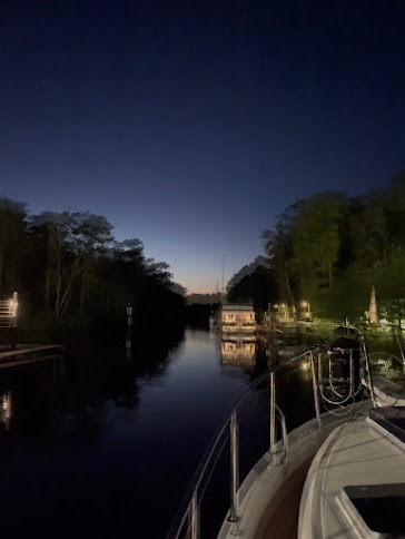
Trying to capture the Northern Lights

Drama ahead.  It had been reported that construction at the Onslow Beach swing bridge would be shutting down the ICW for entire weekday stretches starting on Mon 5/13 and continuing until the end of June.  This section connects Wrightsville Beach to Swansboro and ultimately Beaufort.    Oddly, this was all being reported via the bridge tenders and construction company.   We never saw an official Coast Guard Local Notice to Mariners (LNM).  Right up through Sunday night we continued getting mixed reports and rumors.  The only alternative route is running offshore from Masonboro Inlet to Beaufort Inlet.  Complicating that plan, Monday was the only day with reasonable 1-2' sea conditions forecast before turning to 3-4-5' seas for the balance of the week.  We decided we needed to get moving.  If the bridge truly did get shut down, we needed that Monday for offshore.  All day Sunday we kept checking sources.  Still mixed and no official LNM.   In the meantime, we had gotten an early start leaving Osprey at 7:00 and enjoyed a pleasant few hours cruising before the Myrtle Beach boating crowd started waking up. 

Osprey and it's huge nest guarding
 the entrance to Osprey Marina

I long for the good ole days when the ICW from
Osprey to Myrtle Beach looked like this

Instead of this!

From 10:30 until well after we anchored it was a constant stream of small boaters out enjoying a lovely, sunny Mother's Day.  Can't blame them...but aggravating for us. This entire stretch has become one long section of developed land.  Homes, docks, boats, people.  At least no flies or no-see-ums to contend with.  But I much prefer the solitude and quiet beauty of the GA and SC lowcountry areas for cruising. 

Passing Lightkeepers Marina - our home for 6 months last year

Center consoles with twin and triple outboards - the boat of choice around here

Enjoying the day on the sandbar.

We dropped anchor after a long day right beside Masonboro Inlet.  Late afternoon but the sandy beach areas were still loaded with the last of the day boaters.  By dusk they and their wakes were gone and we had a peaceful night at anchor.  Evening reports sounded more confident the bridge closing would be delayed, but still no official LNM so we committed to leaving in the morning on an offshore route. 

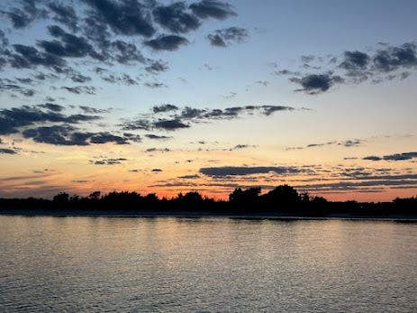
Peaceful sunset at Wrightsville Beach

Journey for May 12, 2024

Mon. May 13, 2024  Wrightsville Beach to Beaufort, NC   9.5 hours and 81 miles

Up early.  Still no LNM for the bridge. Weather says 2' seas and 6 second periods between waves.  Very doable so we head out. A bit choppy outside the inlet but we figured it would settle down.  WRONG!    Our heading is a straight shot to Beaufort. 

Early morning heading out due east into sun
 
It takes us about 5 miles offshore and outside the restricted entry area for Camp Lejeune.   Seas are more like 3-4' with a short period.  Confused but mostly on the bow. We try running our normal 1400 rpm but it feels like we're pounding.   Try up on plane telling ourselves don't worry about fuel burn. But then the wind is blowing copious amounts of spray up we don't like. Finally settle into a 1200 rpm pace and 8.5 mph.  Reduces the pounding but will mean a bit longer day out here.  Martha feels a bit queasy but works through it.  Autopilot is working itself silly trying to hold course.  An aircraft carrier is running hovercraft landing exercises just off the restricted area at Camp Lejeune. Watched them come in and land through the back belly several times while the carrier shadowed us passing the zone.

Hovercraft entering rear landing bay on carrier

View from our lower helm 

We make it to Beaufort late afternoon and tie up at Homer Smith's Marina.  First time here.  Great marina.  Just a little further from town but still easily walkable.  Courtesy car, free laundry, new bathrooms.   All top notch.   We get a prime T head spot.  Exhausted after 2 long and grueling but very different days - we both crash by 8:30 for a long fitful night's sleep. We'll stay a few days to recoup.  Bad weather - rain, winds, possible hail over the next 2 days. The 39' Kady Krogen Avalon is docked behind us.   We met Rich and Terrie doing our Loop in 2019.  They were in our group of boats that ran offshore NJ and took pictures together passing the Statue of Liberty.  Great catching up with them.   The local AGLCA harbor hosts graciously coordinated docktales for 10+ looper boats who are in Beaufort
Tuesday evening.  Very fun to feed off the excitement of these in-progress new loopers.

Tues. evening sunset after a rainy windy day

Looper docktale night in Beaufort

Journey for May 13, 2024


Saturday, May 11, 2024

May 10-11, 2024 Santee River and Osprey Marina

May 10, 2024  Church Creek to North Santee River  72 miles  8.3 hours

Decided for another early start as the weather is looking unpredictable for the day.  More storms passing through.  Some possibly as early as 10AM.   We should be across Charleston Harbor by then.   Operate boat from pilothouse all day.  Nice reprieve from the bugs.  

New monstrosity of a boat storage rack at Ross Marine
 can't help but catch your eye.

Fellow Loopers sent this nice picture of As You Wish
as we passed their anchorage

With the balance of Johns Island behind us we're ready to tackle Elliots Cut.  It connects Charleston Harbor and the Stono River which are on different tide schedules - meaning water rushes through.   We briefly fight the swirling 2 kt current but power through.  Some of the most severe shoaling on the ICW currently is at the Ben Sawyer bridge passing Isle of Palms.   Thankfully we are up 4.5' on a still rising tide.  The depth alarm is blaring and showing less than 2' under our keel. Slight pucker factor.  The VHF radio continues to announce severe weather alerts.  We manage to stay in between the main isolated cells with just occasional light rain but it remains a gloomy day.  

Heading into Elliot Cut

Charleston waterfront as we prep to cross the harbor

Pass McClellanville on a low tide.  This area was dredged just a few years ago but is already shoaling.  We manage it for now but will need to consider tide timing in the future.  Not much traffic out today so it's an enjoyable cruise in the SC coastal low country marshes. Had intended to anchor in Minim Creek but input wrong end point as North Santee River on autoroute.  Thought something was wrong since depths weren't matching what I remembered from anchoring there on a trip south last November.  Finally figured it out and all worked out okay with Santee anchorage.  Still good depths and wide open. Strong wind after dark as last of the cold front passed but we were spared the lightning and rain we could see around us.  Boat moved back and forth with the tide overnight, but anchor held steady despite some aggressive tugs from wind gusts.  Good overall day for dolphin watching with multiple pods riding our surf. 

Dolphins enjoying the wake on our side

Journey for May 10, 2024

May 11, 2024  North Santee River to Osprey Marina  45 miles  5.1 hours

Beautiful sunny and cooler morning to start the day.  Looks like we've got 2-3 days of nice weather ahead. Early start again as we're not sure where we'll wind up for the night.  At 8 am as soon as the office is open, we call our friends at Osprey Marina to see if they have an available transient slip.  They do, so a short day.  This is always an interesting transitional section of ICW.   We start in low country marshland, then move into open Winyah Bay, then move past abandoned rice fields before entering the wooded swamplands of the Waccamaw River. Four completely different ecosystems just miles apart. 

Beautiful weather day as we wind our way up the Waccamaw River

We're happy with calling it a short day before the weekend parade of jet skiers, pontoon party barges and wannabe fishermen in center consoles begin cruising up and down the river.  Martha does a lot of driving today and even takes charge of both docking and undocking as we stop at Wacca Wache Marina for fuel and a pumpout.  Took on 200 gallons after covering about 335 miles. So, averaging almost 1.7 mpg while cruising in our 13-1400 rpm sweet spot.  I can make the numbers MUCH worse punching the throttles  - which we did for a short time crossing Winyah bay.  Clean bottom still gets to 2900 rpm WOT and 23+ mph. Always good to be back at Osprey Marina and seeing the staff.  We've had several extended stays here and they always treat us well.   Big bonus was getting a visit from my brother Paul who was vacationing at Garden City beach.

Brother Paul joins us for a late afternoon visit

Journey for May 11, 2023


Thursday, May 9, 2024

May 7-8-9, 2024 Cowen Creek and Marine Propulsion and Wadmalaw Island

May 7, 2024   River Oaks to Cowen Creek Anchorage 73 miles   8.75 hours

Sunrise over the Ogeechee and As You Wish pre-departure

Not gonna lie.   Other than some excitement at the start of the day, the rest was just long and boring.  So, lets jump in with the excitement. There was an alligator at the marina. 

Only about 3' long but makes you wonder "Where's his mama??"

We had the boat all provisioned after our stay at home and cast off without issue. 9 AM departure on the last of the rising tide, so good water for our trip to the ICW.   First mate did an awesome job getting us cast off and we easily sidestepped our way off the dock unassisted.  Started heading downriver and after getting to the first bend the starboard engine cut off.  This is where the real excitement begins!  No overheat alarms, no low-pressure bells, no weird underwater thumps.  It just quit.   Try restart and nothing.   Port engine is still going so put it in neutral.  Think, Think, Think through the possibilities.  FUEL!!!   Rush down below, through the salon, out the back door, down the lazarette stairs and into the engine room.   DANG!!  Sure enough, in my rush to go I had reopened the water seacocks but had failed to open the fuel valves.  I always close both these items when we'll be stationary for any length of time and even have a reminder note place at the helm.  First time this has ever happened to me.   Open the valves, head to the helm and try refiring the engine.   Turns but won't fire. Now - THINK, THINK, THINK.   What did the mechanic say was the sequence for bleeding the fuel line?   Crack the bolt on top of the fuel filter housing, unscrew the manual pump handle and pump until fuel bleeds.  Do it, retry the engine.  Still no start.  Martha and I are swapping ownership of the throttle controls as she's on the flybridge trying to hold position in the current while I'm trying to start it from the pilothouse. Back to the engine room.   Bleed it again. Try to start again.  Still nothing.   Third time I bleed off from the screws on both fuels filter housing.   Back at the helm again and it sputters.   Try again and it finally starts up.  Yeah for us!!   Crisis averted.  

Now just a long slog to the ICW.  We take a cut through to the Little Ogeechee which saves us going through Hell Gate and eventually dumps us on the Vernon River at the ICW.   Then past Isle of Hope, Thunderbolt and eventually across the Savannah River.  Unusual for us, but no container ship in sight as we cross.   Once into SC we are attacked by flies again.   On and off all afternoon depending on having a breeze. I had forgotten how many no wake zones make up this section of GA and SC. Made even more maddening when the current seemed perpetually against us.  We finally pass Daufuskie and Hilton Head islands, cross Port Royal Sound and head up Cowen Creek for the night.  

Tourists parasailing at Hilton Head


Sunset over Cowen Creek


Journey for May 7, 2024

May 8, 2024  Cowen Creek to Machine Propulsion   56 miles  6.6 hours

Buildings at Parris Island


Revelry across the river at Parris Island Marine Base wakes us up early.  Anchor up at 8.  We'll be traversing several narrow cuts today and want to try to hit them before low tide.   Thankfully the flies were less of an issue today.  Not much happening on the ICW today regarding other boats.  Mostly just us with exception of a few small fishing boats and a southbound sailboat and trawler.  That made occasional dolphin sightings a highlight. 

Slow day on the water

Mom teaching calf how to surf the boat wake

Lowcountry scenery - pelicans in flight

More dolphin sightings

Water through here is either pulling or pushing all the time with speeds either 7.5 or 11.5mph.  Current is amplified in this area due to the unusual 8' tidal swings. The cuts we traversed were Ashepoo, Fenwick and Watts.   They were finally dredged last year so no longer an issue, but they were so bad they became almost impassible at anything but high tide.   We did manage to hit the creek up to MP at dead low tide but since we've been here before we knew we could get in.  One small area with a 5' hump, the rest at 8-10'.  Tonight, we've got plans for dinner at a new Mexican restaurant with friends Gene and Paula who live nearby on Johns Island (our hailing port).

John, Gene, Martha and Paula after a great dinner.

Journey for May 8, 2024

May 9, 2024  -  Marine Propulsion to Church Creek  17 miles   2.0 hours

We got hauled out at 8:30am on the high tide.  The bottom was amazingly in great shape.  Paint is 2 years old and boat has sat idle for some extended timeframes this year which usually gives plenty of opportunity for marine growth. Nothing on her but a little slime and a few barnacles on the running gear.  A quick pressure wash of the bottom and new zincs on the shafts and transom and we were back in the water by 10:30. Drop a B.O.A.T. unit at the front desk and we were off the dock.  

Always a little nervous at the initial lift from water

Up on land and looking good!

Weather not looking so good as we prepare to head out

Weather forecast is not looking good for the day.  Severe storms to the west approaching by early afternoon.  Already lots of reports of severe thunderstorms, winds to 70 mph, hail, tornadoes.  At 12:30 it's decision time. Do we stop now and anchor in Church Creek or continue to an anchorage another 2 hours along but with less protection?  We opt to head into Church Creek, put out a 10:1 storm scope on the anchor line and hunker down. We're joined by three other boats with the same idea. The front arrives early at 2:30. Brief, but intense. Then just rain for a few more hours.  Early anchoring allows time to update the blog.  We'll plan an early start tomorrow to put on some miles.    

Nasty weather on the way


Calm after the storm with a colorful show at sunset


Journey for May 9, 2024


Sunday, May 5, 2024

May 2-3, 2024 Crescent River Anchorage and River Oaks Marina

 May 2, 2024  Cumberland Island to Crescent River - 71 miles 8 hours

Today's challenge was getting through the channel at Jekyll Island on a rising tide.   It is severely shoaled with less than 4' of water in places at low tide.   Catching it at mid rising tide would give us a safety factor to avoid a grounding.   It's about 3 hours travel time from Cumberland and hitting it at 1 PM would have the tide right which meant anchor up at 10.  Plenty of time to sleep in a bit and a leisurely breakfast.

We may have anchored a tad close to this shoal which showed up at low tide. 
We were still safe in 8' so a quick drop-off just like the charts showed.

Easy cruising past the nuclear sub base at Kings Bay (one was in port) so we got the usual escort to insure we kept away and kept moving along. Pretty uneventful cruise around Cumberland Island.  Hit Jekyll perfectly. Tide was showing +2.8 feet and depth finder was showing about 3.5' feet under the hull with an occasional depth sounder "beep" showing less than 3'. Crossed paths with outbound car carrier 'Aquamarine Ace' while crossing the Brunswick River.  It was showing a destination of Baltimore on the Marine Traffic site. Not sure about that until they get the Key Bridge mess cleaned up.

Typical scenery through GA - marsh and occasional land masses

Aquamarine Ace car carrier headed out of Brunswick

The next potential trouble area was Mud River behind Wolf Island.  We were hitting it around 4:00 which was high tide so almost a non-event.  I say almost because out of nowhere we were inundated by a barrage of big green head flies. Got to try out our latest toy - an electronic fly swatter. Bought it for $3 at Harbor Freight so wasn't expecting much but must admit the spark and "zap" sound when hitting one is very gratifying.

Shrimp boat anchored by the Darien River. 


The most fun you can have for $3.

 Made it to our anchorage at Crescent River right at 6pm. Still plenty of sunshine.  Nice open anchorage in the marshes, so catching the last of the day's breeze.  The flies have dissipated but been replaced by the no-see-ums.  Always something!

Journey for May 2, 2024

May 3, 2024  Crescent River to River Oaks - 49 miles 6.5 hours

Departed Crescent River at 9:45 after a peaceful night's rest and another leisurely breakfast.  No hurry as we're again working the tides for a push at the end of the day up the Ogeechee River to our neighborhood marina.  First time up the river. There is a known shoal across the entire width around Ft. McAllister that we need to hit with at least 2.5' of rising tide.  

Severe issue with no-see-ums as we left due to lack of a breeze. Under 10 mph winds all day, so the bugs were a constant companion most of the day.  Only relief was while crossing Sapelo Sound and again at St. Catherine Sound during longer stretches of open water.  Calm conditions across them today but these areas get quite sporty in strong winds with opposing forces from wind, waves and currents.  As we approached the Ogeechee we could see a large ship in the distance.  We're too far away for it to be a ship going into Savannah so wait a bit and determine it's the American Freedom cruise line heading south. We seem to cross paths with this ship on every trip lately.  AIS shows we'll meet at a 90 degree bend in the ICW with shoals sticking out both sides of the channel.  Prudent captain that I am, I opt to slow to idle and pull to the side to allow him unencumbered passage through the bend earning a hearty thanks from the ships bridge. 

American Freedom hooks a 90 degree turn
and passes us on the way to Brunswick.

 The Ogeechee is a pleasant cruise.  Winding and wide, oftentimes fairly deep.  Marsh to the north and treed land to the south with occasional homes.  We pass the earthen works of Ft. McAllister - sight of a civil war battle on land and sea, all part of Sherman's March.  This is the only tricky part of the river where it shallows forcing an abrupt turn to cross straight across from the north shore to the south.   We were riding the incoming tide at plus 3' and saw readings of 3.5' below the keel.  

Passing the restored and historic Ft. McAllister 

Ft. McAllister Marina - That Silverton boat brought back memories from
 a lifetime ago when we cruised the same model up on the Chesapeake Bay.

After that hump, the rest of the way to River Oaks was just winding river and mostly uneventful.  Interesting to see the ancient hand dug cuts into the salt marshes. Remnants from the once thriving rice plantation era in this area. 

Old rice field canal

 The current is still pushing upriver as we arrive at the dock. With a T- head side tie we made it look easy.  Now off to Jacksonville to retrieve the car, do some provisioning and we'll be ready to go again.  


Picture from the drone

And from the land

Journey for May 3, 2024


May 12-13, 2024 Wrightsville Beach and Beaufort, NC

Sun. May 12, 2024   Osprey Marina to Wrightsville Beach  9.8 hours and 90 miles Trying to capture the Northern Lights Drama ahead.  It had b...