Saturday, February 11, 2023

Feb. 8, 2023 Cumberland Island

 Wed. Feb. 8, 2023  Cumberland Island.  

Slept in a bit, breakfast and then unloaded the dingy off the flybridge.  I was hoping it would start up without much difficulty after sitting unused for several months. Also concerned as it had endured a few very cold nights well below freezing while at Osprey.  But once in the water with a few priming pumps on the fuel bulb and she started right up.  Hooray for us!!  When entering the anchorage we saw the vessel Zora Neale. It's a Marine Trader that is identical to our Loop boat and I had communicated with the owner numerous times in the past. They are based out of Fernandina but have done a bunch of traveling with it.   In fact, we passed each other last year while on the Chesapeake but just couldn't ever arrange to meet personally.  So, it worked out great that when they got ready to leave, they came by and rafted up for a visit.  We got to tour each other's boats and finally got to meet in person.  Can't believe we didn't take a single picture.  Bad on us!!

Once Zora Neale left we jumped in the dingy and headed to the dock at Cumberland Island. About 85% of the island is owned by the National Park service. Nature lovers have the maritime forest, endless beach, wild horses and other wildlife, beautiful marshes, and rustic campsites.  History lovers have the ruins of Dungeness - the home of Lucy Carnegie. Before her it was the plantation estate of Catherine Greene.  Both strong women who's husbands died early leaving them to run the island.   

Armadillo hunting for grubs as we started our walk

Boardwalk through maritime forest leading to beach

Boardwalk out to the beach

Upon our arrival the ranger gave us a map and suggested the 4.5-mile loop hike around the south end. The map showed a much more reasonable to us .5 mile hike each way to the beach side of the island.   But once we got to the beach, we decided to stroll down it a bit.  After all, we had been sequestered on the boat and not touched land in over a week.  A little exercise would do us good.  Once down the beach we were at the point of no return so decided, despite our gimpy knees already hurting, to continue on.  Down the beach, over the dune trail, through the marsh walk, past the old cemetery, across the ruins of Dungeness, and finally onto the river trail before making it back to the ranger station. Some 3 hours later with knees, shins, and calf's burning we were done.   Can you tell we don't get out and exercise enough.  Again, Bad on us!!  


All smiles as we start our walk down the beach.
We didn't look quite so smiley by the time we finished.

Found this while scavenging along the beach. 
Decided it was just a bit too big and heavy to bring back with us.


Birds doing a bit of easy fishing during low tide in the marsh 

The ruins at Dungeness - back side facing the marsh.
Destroyed by a suspected arson fire in 1959.

The grand front entrance - guarded by a lone wild turkey today

Cumberland island is known for their wild horses and during our last visit a herd of them was grazing on the grounds at Dungeness, so we were a bit surprised to only see 2 all day walking by the marsh.  They clearly inhabit all areas of the island as manure piles litter every trail creating a constant mine field.  Back to the boat, dingy back up on the flybridge - continuing to get better and faster with that task, then some Aleve, a beverage, and another night of grilling out to end a wonderful day. Tomorrow we make way for Florida.


Our only wild horse sighting of the day

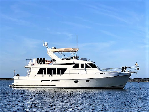
As You Wish riding comfortably at anchor while awaiting our return from shore leave


Feb. 7, 2023 Wolf Island/South River to Cumberland Island

 Tues.  Feb 7, 2023  South River to Cumberland Island  - 53 miles

Anchor up at 7:45.  Nice night's stay here - calm conditions, plenty of swing room, all to ourselves again.  Working the tides yet another day as we have shallow water just past our anchorage in the appropriately named Little Mud River.   Showing 7-8 ' under the keel as we pass through despite the high tide. Given the 7' tide height we would have been stirring up silt or worse at low tide.  Then across The Altamaha Sound with its open water to relieve some stress.  Meander behind St. Simons Island and across the St. Simons Sound before hitting our next bit of ugly depths behind Jekyll Island.   Just as bad as Little Mud River and the Ashepoo up in SC.  All these areas need dredging again desperately and we hope the COE is getting their fair share of money from the Infrastructure Package to get it done and maintained. 

Pelicans keeping a close eye on crabbers tending to their traps

Passing a small island alongside the marshes of GA

Last up was getting around Cumberland Island and into our anchorage at the south end.  This required passing by the entrance to Kings Bay - where the navy maintains their fleet of 6 Triton class submarines.  Big operation.  A sub was onsite and visible as we passed so a heavy patrol presence to keep you away if you strayed too far off the ICW in their direction.  

Triton class sub at Kings Bay. 
 It was ocean bound the following morning.

We had a little more activity on the water today.  More fishermen buzzing by in center consoles but also a few larger boats - some northbound, some south.   The anchorage at Cumberland is well protected by the island but a bit open to the west.  Not an issue as no winds expected for our 2-night stay.   Lots of room here and we had company for a change with 3 sailboats and 2 power boats joining us. Weather has turned warm - into the 70's but nice at night in the 40's or 50's.  Great evening to fire up the grill!!

Sharing our anchorage at Cumberland Island with a few other boats.

Journey for Feb. 7, 2023


Monday, February 6, 2023

Feb. 6, 2023 Vernon River to Wolf Island/South River

Mon.   Feb. 6, 2023  Vernon River to Wolf Island/South River - 51 miles

Another beautiful day out on the water.  Chill in the air with temps in the mid 40's in the AM but made it up to 70 with plenty of sunshine and a light breeze to keep the notorious GA marsh no-seeums at bay.  Our normal departure routine when anchoring is John on the bow retrieving the anchor while Martha is at the helm captaining the boat.  She then takes the first shift out the anchorage while John gets the anchor washed and secured.  She proved her stuff today as shortly after starting todays voyage we had to navigate through "Hell Gate", a notorious short but tight and shallow connector cut between the Vernon and Ogeechee rivers.

Martha takes us through "Hell Gate"

Favorable tidal height for our trip today as we moved along the meandering narrow ICW passages behind several of Georgia's out islands - Ossabaw Island, St. Catherines Island and Sapelo Island.  In between the islands are areas of open sound giving a nice relaxing ride in wider deeper waters.  This area is noted for being primarily marshlands so vistas are low, flat and wide open.  

Typical open and exposed Georgia marshlands at anchor

We got to our anchorage an hour before low tide with just a 1' tide and dropping.  No way we're going further as the next stretch just ahead is the appropriately named Little Mud River.  Navigation notes warn of water depths at 3-4' at low water in places so we'll wait until morning and high tide to make our way through.  Lazy afternoon just enjoying the sunshine and then another sunset at anchor. 

Blowing the conch horn at sunset to signal the end to another day

Got a treat after dinner. Despite an almost full moon shining to the north, we had super dark sky to the south. SpaceX launched a rocket at 8:32PM from Cape Canaveral and we were able to clearly  watch it's ascent.  

SpaceX launch reflecting in the water


Journey for Feb. 6, 2023


Sunday, February 5, 2023

Feb. 5, 2023 Cowen Creek to Vernon River

 Feb. 5, 2023  Cowen Creek to Vernon River  56 miles

Slept in just a bit as the bed was just top comfy and toasty warm!  Still able to hit critical areas with proper tide timing and even had time for a little breakfast before the anchor came up at 8:30. Had 10-15 mph winds most of the night which was doing weird things with the boat position as it crossed over the anchor when the tides changed.  Woke up at 4AM hearing new noises that needed to be investigated. Finally determined as the tide went slack the wind was pushing the bow of the boat over the bridle and anchor chain and actually rubbing against the hull underwater.  Once the tide got us fully swung into the new current all was good. Probably didn't help that I had put extra rode out due to the wind, a bit deeper water depth, and the extra 7' of tide here. 

We thought we had spotted the Chinese spy balloon over Surfside Beach, SC
Then realized it was just the full moon coming out early!!  LOL

We didn't have too many areas of significant concern with depth today, but it required a lot of attention to stay in the deepest portions of the meandering channels.  Only able to use Otto (our autopilot) for a short spell crossing the Port Royal Sound.  Otherwise, all manual steering.  Between lots of concentration and manual steering if felt like a longish day even though it was just a normal 6 hours of running. 

Passed a couple of northbound sailboats crossing Point Royal Sound

Aquamaps with COE colored survey plus Bob423 track in blue
gives a route through this narrow passage at Daufuskie Island

This is what that passage looks like from the helm - no room for error here!

Today took us around the back side of Hilton Head Island and Daufuskie Island, across the Savannah River (had to let a container ship and cargo ship head upstream before we crossed), past Thunderbolt and Skidaway Island and finally up the Vernon River to our anchorage.  

Passing the Daufuskie Island Ferry

The old and new Skidway Island Bridges - old bridge waiting to be dismantled

We've stayed here previously for a few days when a strong northerly wind was blowing as there's good protection from houses and trees on a bluff to the north yet a nice marsh view to the south.  Turned really nice after we dropped the anchor around 2:30 with temps in the upper 60's, wind dying off, and the cloud cover finally breaking.  The cruising life offers up days that end like today - a visual gift in every direction!!  Should be super nice the next few days.  Long pants and sweatshirts may finally give way to shorts and tee shirts!!

View towards shore from the bow

View toward the marsh

View from the stern. Reminds us of our sunset views at the lake house. 

Most of our Journey for Feb. 5, 2023

.

Feb 4, 2023 Toogoodoo Creek to Cowen Creek

 Sat, Feb 4 Toogoodoo Creek to Cowen Creek  51.4 miles

There are three significant shoal areas we passed through today so again timing the tide was critical and necessitated a dawn departure.  It was tough getting out of that nice warm bed on this 30-degree morning.  Wound up bookending the day with a pretty sunrise and sunset.

Sunrise over Toogoodoo Creek

Sunset over Cowen Creek

Shoal areas started right after leaving Toogoodoo (love saying that word!) as we went through Watts cut. Got to the worst spot just at high tide so a non-issue.  Next up was Fenwick cut - a short stretch that was another non-issue.  Final shoal area was the Ashepoo Coosaw Cut. Thankfully there was a good 5' of tide helping us through otherwise at low tide we would have been churning mud if not grounded.  We actually avoided this cut taking a longer alternate route during our trip north last year since we would have been coming through on a low falling tide.  Glad we were prudent about that decision.  The rest of our travel day was fairly uneventful other than making sure we got past the "Southern Rose" dragging a line of barges with dredging equipment.  Got around them just before the river narrows heading towards Beaufort.  Not too hard considering he was barely making 3 MPH.

Leaving the "Southern Rose" in our wake dragging a heavy load 

Zipped past Beaufort despite there being a long idle speed zone as we had a 1.5 kt current working in our favor.   Tucked into Cowen Creek  and dropped the hook at 1:00.  We've been enjoying doing these 50-60 miles days, leaving early, dropping the hook early, relaxing, napping, charting, etc. and then finally dinner, some TV and to bed early.   Back on Looper midnight time where we're in bed by 9!!

Journey for Feb. 4, 2023


Saturday, February 4, 2023

Feb 2, 2023 Awendaw Creek to Toogoodoo Creek

 Thurs.  Feb 2   Awendaw Creek to Toogoodoo Creek  60.1 miles

We'll continue to anchor out as much as possible this trip and explore some new anchorages while returning to some we've used before.   The Toogoodoo is one we've used several times south of Charleston.  Good protection, good depths, plenty of swing room.   All the things we wanted knowing we had a 2 or 3 night stay due forecasts for a rainy Friday and very cold and windy Saturday. 

Morning fog. Sometimes thick, sometimes a bit better.

Our day started early - but not so much bright.  As it got light enough to weigh anchor at 7AM it was obvious we would be in for some foggy traveling. Fired up the radar, AIS, and automated fog horn and eased our way onto the ICW.  Visibility was usually at least 1/4 mile or more so not a complete whiteout.  Just required a higher level of concentration and focus. Early departure was required to catch a suitable tide passing through the Isle of Palms area around 9:30. It's another area notorious for shoaling. We arrived with tide at 2.5' and going down. Had the depth sounder scream a time or 2 as we marked less than 3 feet under the keel. We've got a number of additional shoal areas ahead that make planning the trip through SC and GA a challenge.  Fog still with us as we crossed Charleston harbor.

A bit of fog still lingering as we pass The Battery in Charleston

It finally eased up around 11:30 as we exited Elliots Cut and entered the Stono River and our hailing port of John's Island.  Around the island then onto the Edisto River and around Wadmalaw Island.  Passed the commercial Stevens Towing shipyard as they were hauling the "Spirit of Carolina" with their new giant travel lift. Up the Toogoodoo Creek  early enough to set the anchor at 2:30 with plenty of time to fix a nice baked Ziti dinner.

"Spirit of Carolina" heads into the new big Travel Lift at Stevens Towing

Journey for Feb. 2, 2023

Rain overnight Thurs. and half the day on Fri. before a cold front blew it out with nice sunny skies but windy and cold conditions.  Good day to stay at anchor, lounge around, do some route planning and get started with this years blog. 


Toogoodoo Creek anchorage

A decent sunset to end what started as a cold rainy day


Friday, February 3, 2023

We Start Our 2023 Cruising Season!!

 Wed.  Feb 1, 2023  Osprey Marina to Awendaw Creek   60.7 miles

The holidays are over, our 2 month slip rental at Osprey Marina is over, and we're ready to find a bit of warmer weather.  After topping off the water and fuel tanks and pumping out the holding tank we said our goodbyes to the team at Osprey and headed down the Waccamaw River for points south. Specifically, we're headed to the St. Johns River with hopes of exploring it all the way to Sanford. 

Leaving our home base for the past 2 months - Osprey Marina

The forecast was calling for cloudy drizzly weather, but it turned into a very pleasant 75 degree day.   Caught an outgoing current all the way down the Waccamaw - still one of our favorite sections of the ICW as you meander through forested swampland before coming to the open flatlands approaching Georgetown that at one time were fertile indigo and rice fields. 

Warm sunshine shows up as we exit the Waccamaw and head under
 the  Ocean Hiway Bridge north of Georgetown


Once in the Minim Canal you come across the unique Minim Canal Bridge
 - a floating barge swing bridge

A quick sniff of the air as we passed the papermill in Georgetown verified stopping there was inadvisable today.  Besides, we wanted to make time as we had a favorable tide height for passing through the once again growing shoals around McClellansville.  Easily passed through with the help of an extra 2.5' of tide. No problems and even got our first dolphin sightings. Traveling this time of year is unique with so little traffic.  Passed one boat all day - a sailboat headed north up the Waccamaw.  

Wildlife scenery along the ICW.
Can you spot the white heron?

Made it to our anchorage for the night - Awendaw Creek.   This is a new anchorage for us but one worth remembering.   Easy in/out from ICW.   Good anchoring depth of 10-12', plenty of swing room and room for multiple boats.  Drawback is it can get crowded during the migration season and it's very exposed surrounded by marsh grass - making it buggy in warm still conditions.  We were hoping for a nice sunset over the marsh to end a wonderful first day back on the water. Unfortunately, the weather gods finally brought in that dreary weather and so we ended with dinner and early to bed planning a first light departure the next day. 

Journey for Feb1.2023


August 22, 2026 Salem, Mass.

  Sat. and Sun. August 22-23, 2026   Boston Mass to Salem Mass.  24 miles and 2.9 hours More tight maneuvering to get out of our slip at Con...