Monday, February 6, 2023

Feb. 6, 2023 Vernon River to Wolf Island/South River

Mon.   Feb. 6, 2023  Vernon River to Wolf Island/South River - 51 miles

Another beautiful day out on the water.  Chill in the air with temps in the mid 40's in the AM but made it up to 70 with plenty of sunshine and a light breeze to keep the notorious GA marsh no-seeums at bay.  Our normal departure routine when anchoring is John on the bow retrieving the anchor while Martha is at the helm captaining the boat.  She then takes the first shift out the anchorage while John gets the anchor washed and secured.  She proved her stuff today as shortly after starting todays voyage we had to navigate through "Hell Gate", a notorious short but tight and shallow connector cut between the Vernon and Ogeechee rivers.

Martha takes us through "Hell Gate"

Favorable tidal height for our trip today as we moved along the meandering narrow ICW passages behind several of Georgia's out islands - Ossabaw Island, St. Catherines Island and Sapelo Island.  In between the islands are areas of open sound giving a nice relaxing ride in wider deeper waters.  This area is noted for being primarily marshlands so vistas are low, flat and wide open.  

Typical open and exposed Georgia marshlands at anchor

We got to our anchorage an hour before low tide with just a 1' tide and dropping.  No way we're going further as the next stretch just ahead is the appropriately named Little Mud River.  Navigation notes warn of water depths at 3-4' at low water in places so we'll wait until morning and high tide to make our way through.  Lazy afternoon just enjoying the sunshine and then another sunset at anchor. 

Blowing the conch horn at sunset to signal the end to another day

Got a treat after dinner. Despite an almost full moon shining to the north, we had super dark sky to the south. SpaceX launched a rocket at 8:32PM from Cape Canaveral and we were able to clearly  watch it's ascent.  

SpaceX launch reflecting in the water


Journey for Feb. 6, 2023


Sunday, February 5, 2023

Feb. 5, 2023 Cowen Creek to Vernon River

 Feb. 5, 2023  Cowen Creek to Vernon River  56 miles

Slept in just a bit as the bed was just top comfy and toasty warm!  Still able to hit critical areas with proper tide timing and even had time for a little breakfast before the anchor came up at 8:30. Had 10-15 mph winds most of the night which was doing weird things with the boat position as it crossed over the anchor when the tides changed.  Woke up at 4AM hearing new noises that needed to be investigated. Finally determined as the tide went slack the wind was pushing the bow of the boat over the bridle and anchor chain and actually rubbing against the hull underwater.  Once the tide got us fully swung into the new current all was good. Probably didn't help that I had put extra rode out due to the wind, a bit deeper water depth, and the extra 7' of tide here. 

We thought we had spotted the Chinese spy balloon over Surfside Beach, SC
Then realized it was just the full moon coming out early!!  LOL

We didn't have too many areas of significant concern with depth today, but it required a lot of attention to stay in the deepest portions of the meandering channels.  Only able to use Otto (our autopilot) for a short spell crossing the Port Royal Sound.  Otherwise, all manual steering.  Between lots of concentration and manual steering if felt like a longish day even though it was just a normal 6 hours of running. 

Passed a couple of northbound sailboats crossing Point Royal Sound

Aquamaps with COE colored survey plus Bob423 track in blue
gives a route through this narrow passage at Daufuskie Island

This is what that passage looks like from the helm - no room for error here!

Today took us around the back side of Hilton Head Island and Daufuskie Island, across the Savannah River (had to let a container ship and cargo ship head upstream before we crossed), past Thunderbolt and Skidaway Island and finally up the Vernon River to our anchorage.  

Passing the Daufuskie Island Ferry

The old and new Skidway Island Bridges - old bridge waiting to be dismantled

We've stayed here previously for a few days when a strong northerly wind was blowing as there's good protection from houses and trees on a bluff to the north yet a nice marsh view to the south.  Turned really nice after we dropped the anchor around 2:30 with temps in the upper 60's, wind dying off, and the cloud cover finally breaking.  The cruising life offers up days that end like today - a visual gift in every direction!!  Should be super nice the next few days.  Long pants and sweatshirts may finally give way to shorts and tee shirts!!

View towards shore from the bow

View toward the marsh

View from the stern. Reminds us of our sunset views at the lake house. 

Most of our Journey for Feb. 5, 2023

.

Feb 4, 2023 Toogoodoo Creek to Cowen Creek

 Sat, Feb 4 Toogoodoo Creek to Cowen Creek  51.4 miles

There are three significant shoal areas we passed through today so again timing the tide was critical and necessitated a dawn departure.  It was tough getting out of that nice warm bed on this 30-degree morning.  Wound up bookending the day with a pretty sunrise and sunset.

Sunrise over Toogoodoo Creek

Sunset over Cowen Creek

Shoal areas started right after leaving Toogoodoo (love saying that word!) as we went through Watts cut. Got to the worst spot just at high tide so a non-issue.  Next up was Fenwick cut - a short stretch that was another non-issue.  Final shoal area was the Ashepoo Coosaw Cut. Thankfully there was a good 5' of tide helping us through otherwise at low tide we would have been churning mud if not grounded.  We actually avoided this cut taking a longer alternate route during our trip north last year since we would have been coming through on a low falling tide.  Glad we were prudent about that decision.  The rest of our travel day was fairly uneventful other than making sure we got past the "Southern Rose" dragging a line of barges with dredging equipment.  Got around them just before the river narrows heading towards Beaufort.  Not too hard considering he was barely making 3 MPH.

Leaving the "Southern Rose" in our wake dragging a heavy load 

Zipped past Beaufort despite there being a long idle speed zone as we had a 1.5 kt current working in our favor.   Tucked into Cowen Creek  and dropped the hook at 1:00.  We've been enjoying doing these 50-60 miles days, leaving early, dropping the hook early, relaxing, napping, charting, etc. and then finally dinner, some TV and to bed early.   Back on Looper midnight time where we're in bed by 9!!

Journey for Feb. 4, 2023


Saturday, February 4, 2023

Feb 2, 2023 Awendaw Creek to Toogoodoo Creek

 Thurs.  Feb 2   Awendaw Creek to Toogoodoo Creek  60.1 miles

We'll continue to anchor out as much as possible this trip and explore some new anchorages while returning to some we've used before.   The Toogoodoo is one we've used several times south of Charleston.  Good protection, good depths, plenty of swing room.   All the things we wanted knowing we had a 2 or 3 night stay due forecasts for a rainy Friday and very cold and windy Saturday. 

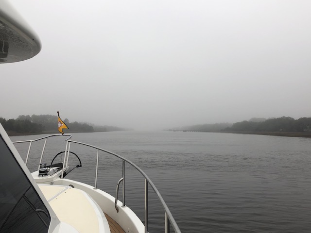
Morning fog. Sometimes thick, sometimes a bit better.

Our day started early - but not so much bright.  As it got light enough to weigh anchor at 7AM it was obvious we would be in for some foggy traveling. Fired up the radar, AIS, and automated fog horn and eased our way onto the ICW.  Visibility was usually at least 1/4 mile or more so not a complete whiteout.  Just required a higher level of concentration and focus. Early departure was required to catch a suitable tide passing through the Isle of Palms area around 9:30. It's another area notorious for shoaling. We arrived with tide at 2.5' and going down. Had the depth sounder scream a time or 2 as we marked less than 3 feet under the keel. We've got a number of additional shoal areas ahead that make planning the trip through SC and GA a challenge.  Fog still with us as we crossed Charleston harbor.

A bit of fog still lingering as we pass The Battery in Charleston

It finally eased up around 11:30 as we exited Elliots Cut and entered the Stono River and our hailing port of John's Island.  Around the island then onto the Edisto River and around Wadmalaw Island.  Passed the commercial Stevens Towing shipyard as they were hauling the "Spirit of Carolina" with their new giant travel lift. Up the Toogoodoo Creek  early enough to set the anchor at 2:30 with plenty of time to fix a nice baked Ziti dinner.

"Spirit of Carolina" heads into the new big Travel Lift at Stevens Towing

Journey for Feb. 2, 2023

Rain overnight Thurs. and half the day on Fri. before a cold front blew it out with nice sunny skies but windy and cold conditions.  Good day to stay at anchor, lounge around, do some route planning and get started with this years blog. 


Toogoodoo Creek anchorage

A decent sunset to end what started as a cold rainy day


Friday, February 3, 2023

We Start Our 2023 Cruising Season!!

 Wed.  Feb 1, 2023  Osprey Marina to Awendaw Creek   60.7 miles

The holidays are over, our 2 month slip rental at Osprey Marina is over, and we're ready to find a bit of warmer weather.  After topping off the water and fuel tanks and pumping out the holding tank we said our goodbyes to the team at Osprey and headed down the Waccamaw River for points south. Specifically, we're headed to the St. Johns River with hopes of exploring it all the way to Sanford. 

Leaving our home base for the past 2 months - Osprey Marina

The forecast was calling for cloudy drizzly weather, but it turned into a very pleasant 75 degree day.   Caught an outgoing current all the way down the Waccamaw - still one of our favorite sections of the ICW as you meander through forested swampland before coming to the open flatlands approaching Georgetown that at one time were fertile indigo and rice fields. 

Warm sunshine shows up as we exit the Waccamaw and head under
 the  Ocean Hiway Bridge north of Georgetown


Once in the Minim Canal you come across the unique Minim Canal Bridge
 - a floating barge swing bridge

A quick sniff of the air as we passed the papermill in Georgetown verified stopping there was inadvisable today.  Besides, we wanted to make time as we had a favorable tide height for passing through the once again growing shoals around McClellansville.  Easily passed through with the help of an extra 2.5' of tide. No problems and even got our first dolphin sightings. Traveling this time of year is unique with so little traffic.  Passed one boat all day - a sailboat headed north up the Waccamaw.  

Wildlife scenery along the ICW.
Can you spot the white heron?

Made it to our anchorage for the night - Awendaw Creek.   This is a new anchorage for us but one worth remembering.   Easy in/out from ICW.   Good anchoring depth of 10-12', plenty of swing room and room for multiple boats.  Drawback is it can get crowded during the migration season and it's very exposed surrounded by marsh grass - making it buggy in warm still conditions.  We were hoping for a nice sunset over the marsh to end a wonderful first day back on the water. Unfortunately, the weather gods finally brought in that dreary weather and so we ended with dinner and early to bed planning a first light departure the next day. 

Journey for Feb1.2023


Saturday, December 10, 2022

Dec 2, 2022 Our Cruising Season Comes to an End - Osprey Marina, SC


FAST FACTS: Total Trip  1785 miles,   Engine Hours  203.4,  Fuel Used 1175 gallons.   We therefore averaged 1.5136 miles per gallon,   5.777 gallons per hour and 8.77 miles per hour.  Normal operation was at 1400rpm showing speed just over 10mph.

 Friday Dec 2   Osprey Marina, Socastee, SC  57 miles

After a much needed full and uneventful night of sleep we were up early and off the dock by 7:30. Nice sunny morning but cold again so ran from the pilothouse most of the day.   Fair number of smaller boats out fishing requiring us to slow down to minimize our wake.  It's that time of year when triple play inshore action is available with trout, flounder and redfish. All good eating.    AIS was showing a boat named Bobbie Ann and labeled as "Fishing Vessel" well ahead of us but going just 6.5mph so we knew it was only a matter of time until we caught up.  As we got closer it was obviously not a fishing vessel but a tug.  He was ahead of us as we approached the notoriously shoaled Lockwood's Folly Inlet. We were using the Bob 423 track overlaid on the latest COE survey.  It requires staying on the far right of the channel almost to the shoreline fighting the inlet current, then shooting across to the far-left side of the channel.  We were hitting it at low tide so were watching Bobbie Ann make his way when we noted a number of funny sharp maneuvers.  We got through fine although we saw a few spots with just 4' under the keel.   Bobbie Ann hailed us and said anytime we were ready to pass him just give a shout on Channel 10.   We chatted a bit and learned he draws 11'. Said he puckered up a few times going across the inlet.  Pushed his way through and said "The old girl does a good job hunting for that deeper water".   We got around him and wished him safe travels.  Called him back when we passed through Shallotte Inlet and saw just 2.5' under our keel (7' total depth) at one point.  Said he may have to wait for tide to rise but we eventually saw him behind us.  Still can't figure how he got across that shoaling!

Getting ready to pass Bobbie Ann
Lockwood Folly Inlet crossing 

Next up was the Little River inlet.  No drama here as it's a major inlet used by the shrimping fleet out of Calabash.  Well marked channel and deeper water. This area is our old stomping grounds.  Just past the casino boat docks is Mariners Pointe Marina where we kept our Trojan 9 Meter International for several years before we moved to Fl. Lots of good memories fishing offshore trolling for kingfish, mahi, yahoo, spanish or bottom fishing for snapper, grouper, etc.  


"Big M" and "The Big M" casino boats at Little River.
Buildings in background on left are at Mariners Pointe.

Heading into Myrtle Beach and the multiple slow/no wake zones. Plenty of development continues along the ICW which amounts to little more than a ditch here. We seemed to be in perpetual low tide all day as we traveled along so not a big surprise when we entered the section called "The Rock Pile" at low water. I actually prefer it then as you can see the hard rock outcroppings that have damaged a number of unsuspecting boats when hidden by higher water.   Overall, not much traffic other than a few sailboats flying Canadian flags heading south for the winter.   One last bridge at Socastee who opens on demand then a few more miles and we were heading into the entrance channel for Osprey Marina and our home port for the next two months.

Passing the "Barefoot Queen" in the ditch.

After settling in at Osprey Marina learned my brother Paul (yes, another brother) and his wife LeeAnn were at their condo in Garden City for the weekend. Made plans to meet up with them at Murrells Inlet on Sat. for a walk around the marsh walk to view the Christmas decorations and then grab some dinner at the Dirty Dog restaurant while watching the ACC Championship football game between Clemson and UNC.  Fun game for Martha and me as Clemson finally made a QB change and got things going to easily defeat UNC.  Not quite as much fun for Paul and LeeAnn.  Always great to see family!!

John, Martha, LeeAnn and Paul showing our team colors

We had an interesting follow-up a few days after docking at Osprey Marina.  Boating friends sent Martha a link to a video on Facebook (I still refuse to subscribe - scourge of the earth!) of our boat heading down the Waccamaw River to Socastee.  Apparently, there's a guy who films passing boats and posts them on his Facebook page - Show Us Your Boat.  Great video but I'm not tech savvy enough to figure out how to post it here. Martha managed to grab a screenshot. 

Picture from Show Us Your Boat on Facebook.
Growing that ICW moustache on the bow!


Journey for Dec 2
Final trip of 2022


Wednesday, December 7, 2022

Dec 1, 2022 St. James Plantation Marina - Southport, NC

 Thurs 12/1  St. James Marina - Southport, NC  70 miles

We had a bit of an uneasy extra day and night at Mile Hammock.   Only one boat left in the morning - the rest stayed at anchor with us.   Winds would be swapping direction all day and night and gusts were expected up to 35 along with some bands of rain. While the anchorage is protected enough that no choppy waves develop it is still fairly unprotected from winds - especially anything with a westerly orientation.  As can be seen on the screenshots from our anchoring apps, we spun hitting every compass heading during our stay.  We may have even dragged anchor a bit. We never got outside our anchoring safety radius which was good.  Unfortunately, a catamaran anchored nearby did break free at the absolute worst time with high winds and driving rain.  Owner got drenched but managed to get the boat reset about the time the squall passed. Thankfully it was during the day and not the middle of the night.  Felt terrible for him but glad it was not us!  


Navionics plot above - AquaMaps anchor alarm below

As the day wore on the rainy weather started breaking, although the winds continued.  That gave our marine friends an opening for more maneuvers.   Frogmen back in the water training with  undewater scooters.   Then the aerial assault started with touch and go landings again.   At least today the aircraft of choice were much quieter helicopters.

Marine chopper in the afternoon sun

 Wed. AM we were raising anchor early at 6:45. Bit of a NE breeze blowing but we would be in protected waters most of the day with the exception of coming down the Cape Fear River. The wind there would be at our stern so a non-issue.  We had 2 bridges of concern. Figure 8 Island Swing Bridge which only opens on the hour and half hour and then the Wrightsville Beach Bridge which only opens on the hour.   Our plan was getting to Figure 8 at 10:30 and then scoot the 5 miles to Wrightsville for the 11 AM opening.  Not much traffic on the waterway although we did get hailed for a slow pass by Huntress, a large sportfisher who had been following us. He took off after passing us showing a speed over 20mph on AIS which I though odd.  He would still be too late for the 9:30 Figure 8 opening so wouldn't be able to make the 10 AM Wrightsville opening.  We meandered along at our 10mph pace to the Figure 8 bridge arriving at 10:20 and were able to proceed unencumbered after lowering our VHF antenna due to the extra clearance from a low tide.  Found out from Martha several days later she had a little mishap while tending to the antenna.  Glad this boat has wide walkarounds and stout railings or I would have been performing a man overboard maneuver.  Approaching Wrightsville, we could see Huntress idling nervously in front of the bridge. We went through the 11 AM opening together recalling that old story about the tortoise and the hare.

We had hoped to see my brother Pete as we passed Carolina Beach where he has a house.  Timing just didn't work out. Several days later my brother Bill told me he had also been in town that day and could have watched us as we went under the Snows Cut Bridge.   Martha took a turn at the wheel for some of the "fun" driving today.  Took us through the narrow and twisting Snows Cut with a strong current pushing us hard from behind.    Then out into the Cape Fear River where a 2+ knot incoming current slowed our progress making for a tense passing of a fast-moving incoming tanker. Finally, back on the ICW and passing Southport which is our normal stopping point.   We had decided this would be a little longer travel day to insure arrival at Osprey Marina on Thurs. by midafternoon.   So, on we pressed for a few more miles and into St James Marina for the night.   A simple sign on the ICW and a narrow easily missed entrance channel leads into the marina. It's part of a private larger development but also accepts transients. Very protected, nice folks, restaurant on site, decent rates, clean restrooms.  Took on 120 gallons of diesel just so tanks would be about 2/3 full.  Not the best price but certainly better than most.  Dinner on board to keep cleaning out the fridge and then early to bed.

Dockmate at St. James Marina decorated for Christmas


Journey for Dec 1

September 2. 2026 September in Maine - On to The Basin

Wed./Thurs.  Sept 2-3, 2026    Snow Island to The Basin   8 miles and 1.5 hours Just an hour's cruise as we switch over to a new anchora...